Meet the new trekking route that crosses 2,800 km of protected areas and beautiful landscapes
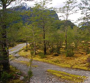
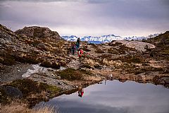
Among the pristine forests of southern Chile is the longest scenic trekking route in the world. Dubbed the Patagonian Parks Route, it is a 2,800-kilometer trail that passes through 17 National Parks. 11.5 million hectares of scenic beauty, a refuge for endangered species and home to more than 60 communities that still preserve their culture and traditions.
The Patagonian Parks Route links the Austral Highway with the Patagonian Channels and the End of the World Route. It is a journey that allows you to appreciate ancient forests, walk through glaciers, climb mountains and navigate rivers by kayak.
This incredible trail is a project based on tourism as a consequence of conservation. Promoted by Tompkins Conservation and Imagen Chile, its objective is to guarantee the protection of the biodiversity of the area, inhabited by 140 species of birds and 46 species of mammals; and strengthen the country's global positioning as a destination of natural beauty in a framework of sustainability.
Here is a list of the national parks that are included in the Patagonian Parks Route:
- Alerce Andino
- Hornopirén
- Douglas Tompkins
- Corcovado
- Melimoyu
- Pumalin & Queulat
- Magdalena Island
- San Rafael Lagoon
- Cerro Castillo
- Patagonia
- Bernardo O'Higgins
- Kawésqar
- Torres del Paine
- Pali-Aike
- Alberto de Agostini
- Yendegaia
- Cabo de Hornos
On the website of the project, there are downloadable maps, suggested excursions, information about the area, accommodation tips, pictures and more than 50 GPS traced paths.
Chilean Patagonia is one of the least populated places in the world, one of the few corners of the planet that remain peaceful and in calm. This route is a gift for the world and an unmissable panorama for mountaineers, climbers, and adventure-tourism lovers.
Do you dare to make the route?
Live the experience

Trekking Torres del Paine - W Camping Self Guided5 Days
Travel package of 5 days to make the W circuit in Torres del Paine National Park. On this trekking you will visit the best places of…
- FromUS$1.532per person

The Best of the Northrn Carretera Austral7 Days
Experience the magic of the Northern Carretera Austral on a 7-day journey filled with wild landscapes, natural hot springs, and ancient…
- FromUS$1.467per person

Circuit W in Camping September - April Self-guided5 Days
The W route is one of the trekking circuits to do in the Torres del Paine National Park and one of the best routes to see the main…
- FromUS$1.532per person

Excursion to the National Park Queulat12 Hours
One of the main attractions of the northern austral highway is the Queulat National Park, known for its nature and the Hanging Snowdrift.…
- FromUS$111per person

Trekking in Alerce Andino National ParkFull day
The Alerce Andino National Park houses the largest expanse of native larch forest. In this tour we will trek through its trails to…
- FromUS$79per person

Catamaran sailing through the San Rafael lagoon13 Hours
We will navigate fjords and channels of the Chilean Patagonia by catamaran from Puerto Chacabuco to the Laguna San Rafael National…
- FromUS$295per person


