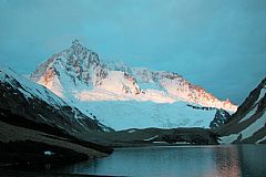
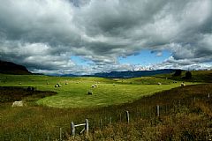
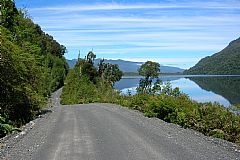
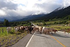
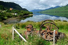
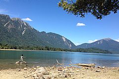
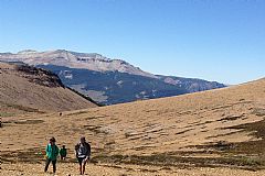
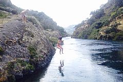
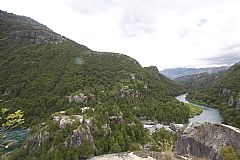
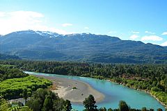
Patagonia has more than one million square kilometers, of which a quarter is Chilean, and covering the world's most extraordinary landscapes: glaciers, fjords, cold forests, ice fields, lakes, rivers and Plains.
In Chile, the Patagonia reaches from the heart of Reloncavi in the north to the Strait of Magallenes in the south, excluding the large island of Chiloe and its interior archipelago, with the same going for Tierra del Fuego (Land of the Fire) and its archipelago in the south.
A difference from the rest of the country, in this part of the national territory it extends from the eastern side of the Andes to the ocean, and where the Cordillera de la Costa (Mountain Range of the Coast) forms innumerable archipelagoes that characterize the region. The areas contain three climatic zones: littoral (Aysen), where more than 3,000 mm (118 inches) of rain fall annually; the intermediate or transition (Coyhaique) with 950 mm (37 inches) annually; and the pampa or steppes (Balmaceda), with 500 mm (20 inches) annually.
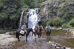
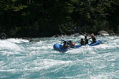
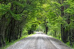
Nowadays, to talk about the Austral Highway and the Northern Patagonia is almost the same thing. From the heart of Reloncavi until the Northern Iceberg, this route travels through a territory that thanks to her, is one of the most preferred destinations by tourists. Adventure tourism, fishing, trekking, extreme sports, kayaking, rafting, and observing flora and fauna in their most wild state, are only part of the variety of activities that this region offers.
The Highway from the North to the South
Splitting in Puerto Montt, the Carretera Austral (Austral Highway) allows you to enter the Alerce Andino National Park in its first few kilometers, which is characterized by forests of thousands of alerces, some of which surpass 3,000 years in age. After the transfers in La Arena and Hornopiren, you will arrive in Caleta Gonzalo, which is the starting point from which to explore Pumalin Park, which includes excellent areas for camping, a center for visitors, cafeteria, paths for excursions, cabanas, picnic zones, and sales of crafts.
Chaiten is located to the south of Caleta Gonzalo, and is the starting point to visit the Termas del Amarillo (Hot Springs of the Yellow), the Lake Yelcho and Futaleufu. Lake Yelcho and the surrounding rivers have become one of the favorite destinations for fly-fishers, especially foreigners; and Futaleufu -close to the border with Argentina-, is internationally known for its kayakers, as the river by the same name is considered the most difficult to practice in for people who take part in this sport.
Glacier San Rafael
Further to south and towards the littoral, Puyuhuapi is a small village located near the Ventisqueros fjord. Eleven kilometers (7 mi) away, and accessible only by water, you can find the Hot Springs of Puyuhuapi. From the hot springs you can take a catamaran that allows you to visit the biggest attraction in the region: The San Rafael Lagoon.
To the south of Puyuhuapi, the Austral Highway passes through the Queulat National Park, known for the Salto Padre Garcia Hurtado (waterfall)-just before the portezuelo (small harbor)-, and the fabulous Colgante Glacier, visible from a looking point on the highway.
Past Villa Amengual is the Las Torres Lake National Reserve, and further along is access to Puerto Aysen and Puerto Chacabuco. The first was originally the main port in the region, however, a largest amount of sediment was dragged by the Aysen River, blocking the bay. Because of this, the port moved 15 kilometers towards the west to Puerto Chacabuco.
The highway crosses the Simpson River National Reserve, which was named after the river that crosses it and is renowned among fly-fishers. Among the most beautiful places of this distinguished park, undoubtedly is the Waterfall of the Virgin and the Veil of the Bride Waterfall.
Coihayque is located steps from the Macay Mountain, having a unique plaza with five sides, and includes all services that a tourist would need. Only 29 kilometers (18mi) to the south is the Cerrro El Fraile Ski Center that has two lifts and five trails.
Continuing to the south, you will find some of the most beautiful destinations in Aysen: Lake La Paloma and Lake Elizalde, and the Castillo Mountain National Reserve.
The region of Lake General Carrera is one of the most popular with tourists and is also one of the most beautiful. The main port is Puerto Ibáñez, accessible from the Austral Highway. To the south and west of the lake is Puerto Tranquilo, from where you can rent boats and visit the Marmol Cathedral.
Close to Villa Cerro Castillo there are two sites of archaeological importance: Manos Cerro Castillo National Monument and the site known as RI-4. The first is a collection of hundreds of painted hands, both adults and children, in red tones; and the second is a painting of a guanaco (animal) and its baby.
Fifty kilometers (31mi) to the south is the crossing with the detour that brings you to Chile Chico, reaching the border with Argentina. From this city you can arrive at the Lake General Carrera Reserve and Lake Jeinimeini Reserve. In this region, the Caverna de las Manos (Cave of the Hands) stands out as a unique place where the Tehuelches drew numerous hands in red, black, yellow, and white.
Getting back on the Austral Highway and continuing to the south, arriving in Puerto Bertrand, situated 300 meters (984 ft) from the place where they drained the lake and gave the origin to the Baker River, the wildest in Chile. At the mouth of the river is Tortel, which is known for the color of its houses and runways or gangplanks of wood.
The road follows the course of the river until Cochrane, the last important city in the region. To the east of the city you can find the Tamango National Reserve, famous for its population of huemules, and the Cochrane Lake. From the reserve there are beautiful views towards the valley and the Campo de Hielo Sur (Southern Icefield).
The highway, in its last stretch, continues towards Puerto Yungay, on the shores of the Bravo River - which you cross to continue the route towards Villa O'Higgins, on the border with Argentina. This is the final point on the highway
Destinations: The Top Ten
If your time is very limited and wish to see the destinations that are the most important and best represent the Northern Patagonia, continue reading as we present you our "Top Ten."
1st- San Rafael Lagoon: As part of the San Rafael Lagoon National Park, its main attraction is the glacier (by the same name) that borders the lagoon and is the northernmost glacier in the southern hemisphere. The lagoon is, in reality, an entrance to the ocean, surrounded by the virgin forest and impressive snow-capped mountains. The glacier, 30 meters (100 ft) tall, 4 kilometers (2.5 mi) wide, and 45 kilometers (28 mi) long, it is permanently moving, with large masses of ice breaking off and crashing into the waters of the lagoon. More Information.
2nd- Lake General Carrera - Mármol Cathedral: Its is the second largest lake in South America and is shared with Argentina (where it is known as "Buenos Aires"). Thanks to the presence of the Campo de Hielo Norte (Northern Icefield), this region enjoys a surprising microclimate that is warm and sunny. The Marmol Cathedral is an extraordinary rock formation broken by the water of the lake, turning part of it a turquoise color.
3rd- Futaleufu: This is a small, lost village in the Patagonia. However, it is a destination that is known throughout the world thanks to its river (by the same name) that is a paradise for extreme kayaking and rafting. Labeled as the most difficult in the world, this river is encased within numerous rapids and waterfalls. Similar to Lake Gral. Carrera, Futaleufu has a microclimate and its tourism infrastructure is first rate, although on a small scale.
4th- Cerro Castillo: The Austral Highway that crosses this national reserve in its path towards the city of Cochrane, allowing you to cross the mountain range of Cerro Castillo which separates the watersheds of the Aysen and Ibáñez Rivers. Known for the beauty of the Castillo Mountain (2,320 meters, 7,610 ft above sea level), the Cerro Church (1,750 meters, 5,740 ft), and the Piedra Conde, which is a rock that has been modeled by the elements as a human profile. On the other hand, this small reserve is gaining international attention for its trekking path that is part of the program "Senderos de Chile" (Paths of Chile) operated by Conama (National Corporation of the Environment).
5th- Lake General Carrera - Extreme South: This part of Lake General Carrera and the region that surrounds it, is one of the main areas of sport fishing in the Northern Patagonia.
6th- Lake Bertrand: This beautiful lake of a turquoise-blue color, is located 270 km (168 mi) to the south of Coyhaique, and is the recipient of waters from Lake General Carrera, giving origin to the most abundant river in Chile, the Baker River. It is an excellent destination for fly-fishing and includes surrounding lodges that are perfect for lovers of this sport.
7th- Lake Yelcho: Some 45 kilometers (28 mi) to the south of Chaiten, this lake (of glacial origen) and the rivers that surround it, are very valued to sport fishers. The river is surrounded by mountains and glaciers, and its skirts are covered by thick forests. In this emerald-green lake, you can fish for salmon and trout.
8th- Queulat National Park: the park is characterized by the exuberance of its vegetation and its spectacular waterfalls, however, its main attraction is the Colgante Glacier, a glacier sitting at a point combining two mountains. Thanks to a trail it is possible to visit Lake Risopatron, the Tempanos Lagoon, the seno Queulat, the Padre Garcia Waterfall, and the Waterfall of the Condon. More Information.
9th- Puyuhuapi Hot Springs: Internationally renowned, this thermal center is located in a region of exuberant vegetation and natural beauty, in the beautiful Dorita Bay of of the Seno Glacier. Its thermal waters reach temperatures of up to 85ºC (185°F) and it is recommended for the treatment of rheumatic diseases and for your skin. More Information.
10th- Pumalin Park: Located between Hornopiren and Chaiten, covering an area of approximately 300,000 hectares (741,313 acres), it is the largest private park in the world. Its entrance is through Caleta Gonzalo and includes an excellent area for camping, visitor's center, cafeteria, trails for excursions, cabanas, picnic areas, and craft sales. More Information.
Northern Patagonia is on of the few places in the world where there still is virgin, unexplored, pristine territory. Ideal for the development of tourism of special interests, this region is opening the international and national tourist market. Its most attractive characteristic is the view which it provides.
Live the experience

Travel package Carretera Austral4 Days
For four days, you will discover the best of Aysén. We will sail on Catamaranes del Sur through Laguna San Rafael and explore the attractions…
- FromUS$845per person

Catamaran sailing through the San Rafael lagoon13 Hours
We will navigate fjords and channels of the Chilean Patagonia by catamaran from Puerto Chacabuco to the Laguna San Rafael National…
- FromUS$260per person

Excursion to the National Park Queulat12 Hours
One of the main attractions of the northern austral highway is the Queulat National Park, known for its nature and the Hanging Snowdrift.…
- FromUS$122per person

Marble Chapels Tour10 Hours
The Marble Chapels were declared a National Monument for being formations of mineral and carbonate of sodium. Come here and discover…
- FromUS$122per person


